Hi all... I am making some good progress with btb, however I see alot of folks talking about making tracks from google earth data. I have spent many hours reading though various forums on the subject, but they all seem a little too advanced, as in the information provided assumes you already know the basics on how to get google earth data.
Is there any "first steps" tutorials on how this works?
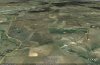
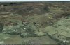
I live in ireland, and was interested in making some open ended rally tracks for RBR based on some of the roads in my local area. As stated above there seems to be good info on google earth to btb, but theres nothing at all on the very early stages of how to aquire the data in the first place. To explain myself a little more clearly, I open up Google Earth, zoom in on a region close to where I live.. I see some road layouts ide like to somehow import into BTB, but in Google Earth there dosent seem to be any options to export data of any kind, (bar location bookmark kml's etc).... How exactly to i tell google earth to export a road as a kml file to import into BTB? ... I tryed everything, things like right clicking on the road, but no right click menu comes up. None of the pull down menus in google earth have anything resembeling "export to kml" (as in road path. not location bookmark)...
Do I have to somhow tell Google Earth to see a road as a path (for kml path export) by creating a route planner, or somthing?? If so how do I make a route? .. Or is it a case that I have to take a screenshot of the road im looking and import it into some other Google Earth Application?
I would be great if somone could explain how to do this first step.. I do relise that there is other work involved, like creating height info in "KML Altitude Fille".. however Im not even at that stage. I need to get past the very very very first stage, which is how to make google earth see what im seeing on my screen, somhow convert what im seeing to a path, then how to export it for use in either KML Altitude Filler or BTB itself.
Some basic basic, first step, baby step info would be fantasic")
Regards
Pan
Is there any "first steps" tutorials on how this works?
I live in ireland, and was interested in making some open ended rally tracks for RBR based on some of the roads in my local area. As stated above there seems to be good info on google earth to btb, but theres nothing at all on the very early stages of how to aquire the data in the first place. To explain myself a little more clearly, I open up Google Earth, zoom in on a region close to where I live.. I see some road layouts ide like to somehow import into BTB, but in Google Earth there dosent seem to be any options to export data of any kind, (bar location bookmark kml's etc).... How exactly to i tell google earth to export a road as a kml file to import into BTB? ... I tryed everything, things like right clicking on the road, but no right click menu comes up. None of the pull down menus in google earth have anything resembeling "export to kml" (as in road path. not location bookmark)...
Do I have to somhow tell Google Earth to see a road as a path (for kml path export) by creating a route planner, or somthing?? If so how do I make a route? .. Or is it a case that I have to take a screenshot of the road im looking and import it into some other Google Earth Application?
I would be great if somone could explain how to do this first step.. I do relise that there is other work involved, like creating height info in "KML Altitude Fille".. however Im not even at that stage. I need to get past the very very very first stage, which is how to make google earth see what im seeing on my screen, somhow convert what im seeing to a path, then how to export it for use in either KML Altitude Filler or BTB itself.
Some basic basic, first step, baby step info would be fantasic
Regards
Pan