Hello hello everyone,
and welcome back to Targa FLorio!
I hope you guys are all safe and healthy
First of all, I'm sorry that I haven't been very active in the forums. And I also apologize that it takes quite a long time to update this track here.
Been wanting to update the resource here, but keep thinking that I should make more progress before doing so, and finally i think it is the right time to update the public release version.
A little bit of news regarding the development of this track is that we're finally able to get the LIDAR data around the region.
So a big update is coming. We're still working on it to put all the data together, since it's not coming as a standard GeoTiff, but as thousands of chunk of meshes.
It doesn't mean that we will start from scratch, but we will need to move and adjust the already made models to fit the new landscape model.
I hope you guys enjoy this track as much as we do!
Thanks!
Abulzz
Great news to see an update posted here
")
Glad you still have the energy to continue working on such a project.
A word of advice if i may,
Since i came across many projects for work where new models were made available, and it's always the question of redoing the model versus editing the existing.
From my experience, it's very time consuming to edit a model. It's often faster to remodel.
which is always difficult to explain to the client, that after a certain amount of changes, it's starting to add up to the initial price of the job XD
You probably need to balance what's easier depending on the process that led to said model. For instance, if you've spent time doing maping/unwrapping, it's probably simpler to edit rather than remodel, as the unwrap process by itself can be very demanding.
And keep in mind to have some freedom in your edits, nobody will ever know if that turn, or that bump is one meter higher or not
Some freedom for the modeler, means you might have some sanity left at the end of the project


 Vehicle Software Company Marble Labs Announces Potential FFB Replacement TechForce Feedback is essential to enjoying sim racing. US-based vehicle software company Marble...
 Corsair In Pole Position To Purchase Fanatec, Provide Interim Funding (Updated)The plot thickens, as Corsair signs an agreement to “negotiate exclusively” with the beleaguered...
![Luca [OT]](/data/avatars/s/3235/3235113.jpg?1697196734) iRacing Confirms Mustang and Corvette GT3 For 2024 Season 3iRacing have just released their development update blog for May 2024, confirming two...
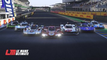
iRacing Confirms Mustang and Corvette GT3 For 2024 Season 3iRacing have just released their development update blog for May 2024, confirming two...