Realistic terrain

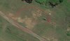
Can someone help me to create a terrain similar to real life on a specific track? I'm talking about the terrain elevation changes.
How could I do that?
I already tried something, my idea was to create paths inside and outside of the circuit separated by 10 meters in Google Earth then import them into BTB as "road" and then add 5m terrain to them on both sides then delete that "road" from the BTB project (so this way only the elevated terrain left) but for some reason the coordinates of these paths are way off, they don't show up where they should compared to the main circuit.
 
I like your idea but I do wonder if the elevations are going to be any closer to reality as your still using Google Earth elevations and you need something that takes elevation readings a lot more often.

At the moment, I think, the only way to do that is with point cloud or visually in BTB, lifting or lowering the terrain.

As far as the coordinates being way off, Google Earth will not keep the view directly from above, so as one moves across GE, you will eventually be looking at it from a certain angle (not 90 degrees) which, I found puts the path farther away from where the eye thinks it is. I thought that just using the arrow keys would keep it directly above, but found out it didn't.

"SAS Planet" -https://bitbucket.org/sas_team/sas.planet.bin/downloads - does keep the plan view so perhaps try that. Uses google Earth again but does keep to the 90 degrees.
 
I already tried something, my idea was to create paths inside and outside of the circuit separated by 10 meters in Google Earth then import them into BTB as "road" and then add 5m terrain to them on both sides then delete that "road" from the BTB project (so this way only the elevated terrain left) but for some reason the coordinates of these paths are way off, they don't show up where they should compared to the main circuit.

I've used that technique. When you import multiple roads like that, each is imported to the center, so you have to manually move the "road" (terrain strip) to where it matches in your layout. I used an 4096x4096 aerial photo for the background and picked on features of the landscape to align my terrain strips. Think you should use fewer terrain strips and put more distance between them, like 50m, since the KML data is not going to be accurate enough for the 10m grid.

Since I do know what you're working on and am really looking forward to it :whistling:, I'll suggest a couple other methods:
a) Create a google earth terrain object, import it, and then use BTB terrain to lay over it.
b) Export a google earth terrain object to Blender. Export your BTB project and import it to Blender. Merge the two.

But, I think the speediest method is to use the terrain strips. Last time I tried a big google earth terrain object in BTB, it was painfully slow to update on-screen (though that was about 3 video card generations ago).
 
Last edited:
Thanks for the suggestions.
Emery: I don't really know what do you mean by "Create a google earth terrain object". With which program and how?
Point b) is out of question because I don't have time to learn Blender or 3ds max that's why I'm doing this in BTB.
 
Use SketchUp (current version)
1) File, Geo-Location, Add Location...
2) Select the terrain you're interested in.
3) File, Geo-Location, Show Terrain
4) File, Save As, use old SketchUp file format

Now you can open SketchUp 6 and resave the file in 6's format which you can use to make an object for BTB XPacker. Insert the object into your track.
 
The "terrain object" method works in a certain degree however there is a "slight" problem with it. At areas where there is a contigous forrest on the ground the Google Earth gives us false altitude numbers, these altitude numbers consist the height of the trees also, so for example if the real altitude would be 300 meters but there is a forrest there then it will give us lets say 320 meters.
At least it seems like it does it because when I finished the terrain based on the terrain object I made some comparisons with videos and the altitude were wrong at those areas, these areas were too high. At clear areas (without trees) it's OK.
Now if I think about it then it's basically almost useless. :D I had to redo almost the entire terrain.

Another topic: I would like to create something like this in BTB - I attached a picture. Do you know a way to do it?
 

Attachments

  • question.jpg
    question.jpg
    67.6 KB · Views: 317

Latest News

Are you buying car setups?

  • Yes

  • No


Results are only viewable after voting.
Back
Top