BTBHD is now in Beta!

T

Travlar

  • Travlar

BTBHD is now in Beta. If you would like to give it a try, please feel free to do so. Please read the launch page first and make sure you have Google Earth installed and the .NET framework 2.0 installed.

This is a no thrills version and you have to put your KML file in a certain directory to have BTBHD read it.

I hope this works as well for you as it has for me. If you place your "nodes" too close while you make your path in Google Earth, you can get some very big jumps in elevation. I found that once the track was imported into BTB, I was able to delete some nodes to smooth out the transitions.

BTBHD 1.0.0.11 can be installed from the link below.

http://www.microvoxsoftware.com and go to the Download Section.

Thanks
 
BTB Lofty currently only supports KML files that contain a Path (i.e. it doesn't like Polygons).

I guess you've probably done all of this already but, just in case, here's the full set of steps for creating a valid path file in Google Earth:

  • From the top menu, choose: Add -> Path
  • Click on as many points along the circuit as you'd like (you don't need to "Close" the circuit, just make sure that the last point is somewhere close to the start - assuming you actually want a closed circuit)
  • Once you've chosen all the points along your path, give the path a name, and close the New Path dialog
  • Right-click on the newly added "Place", and choose "Save Place As..."
  • Change the "Save As Type" to KML, choose the Filename and Location, and click "Save"

Hopefully that answers your last question as well!
 
Gday R Soul & Banger,
Couldnt get Lofty to work for me, even with my "short" tracks.
Then I tried 3D Rout Builder. It worked so well that Ive put my lil'practice bits away & finally got a start on Bungonia.
There's been a couple of hic-cups tho & was wondering if anyone knows of a work around/fix.
I got my track with all the details I was after, but for some reason there is also now a triangular network of roads as part of the track
that should'nt be there.
It may have been due to the fact that 3DRB wouldnt do the whole track at once,but in three stages where they became looped.
I then fed the three loops back into 3DRB and out came my 80km lap track,all-be-it with an annoying addition of a triangle.
Can anyone tell me how I'd go about getting rid of the unwanted bit?
Thanks again everyone,especially Bangers,that software makes it SOoo much easier.
BLeeK
 
Has anyone had experience at merging rout data with 3d route builder?

Has anyone had experience at merging rout data with 3d route builder before feeding it into BTB?
Ive tried various methods but I keep ending up with at least two paths/roads that shouldn't be there,intermingled with my track.
Is there some way around this or should I try to overlay/join them in BTB?
When Ive tried to delete them in 3dRD & BTB, I end up loosing bits of my track that want.
Im not good at scratch building & Ive been heavily relying on GE/GPS data.
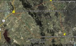
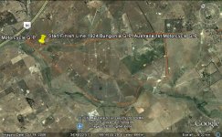
Here's a couple of jpegs to show what I mean.
The trouble is under the bit that says "start/finish line..." There's actually two of them there.
 

Attachments

  • BTB Bungonia TT_bg.jpg
    BTB Bungonia TT_bg.jpg
    92.1 KB · Views: 281
  • BTB Bungonia GP_bg.jpg
    BTB Bungonia GP_bg.jpg
    79.3 KB · Views: 308

Latest News

Are you buying car setups?

  • Yes

  • No


Results are only viewable after voting.
Back
Top