Here is the way how i got my track altitude data. Maybe someone is interested.
I was doing research how to get altitude data for my rallytrack when i started while back. As you know there are some problems with GPS accuracy, even more if you track is in the forest and blocks visibility to satellites.
Alternative to GPS is barometric altimeter. I found particularly interesting http://www.microtim.com/index.htm digital altimeter which is very easy to use and the most importantly acceptable accuracy 1-2 feet, resolution is 1 foot which is about 30cm. This is more than enough. They use it mainly in airplanes to show altitude.
This is more inconvenient way to get your data to PC but you spend more time on the track and getting to know it better. I chose nice sunny day to no big atmospheric pressure changes expected.
First i printed out aerophoto (this is better than map because you know exactly were you are) of the track and went to track with bicycle. Set my altimeter to zero at the start of the track. Now i rode or walked through the track and marked altimeter changes on printed layout. Also marked some bumps, dips and other things what seemed important. Shortly said i marked all the changes on the road i saw. It took, if i remember correctly, 2 days to mark all my 20km long track. Afterwards i went back to the start and checked what my altimeter is showing and it showed zero. That confirmed my data correctness.
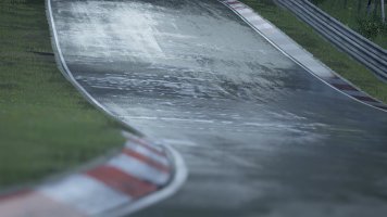
Same aerophoto is my backround image in BTB. It is quite easy to look out marked altitude marks from printed photo what i used on the field and put them in BTB in the same spot.
I'm pleased with the result as my track is relatively level. Didnt need to do much correcting after setting nodes Y positions. Dont know how is it working with lots of ups and downs on the track but i see no reason why it shouldnt.
I was doing research how to get altitude data for my rallytrack when i started while back. As you know there are some problems with GPS accuracy, even more if you track is in the forest and blocks visibility to satellites.
Alternative to GPS is barometric altimeter. I found particularly interesting http://www.microtim.com/index.htm digital altimeter which is very easy to use and the most importantly acceptable accuracy 1-2 feet, resolution is 1 foot which is about 30cm. This is more than enough. They use it mainly in airplanes to show altitude.
This is more inconvenient way to get your data to PC but you spend more time on the track and getting to know it better. I chose nice sunny day to no big atmospheric pressure changes expected.
First i printed out aerophoto (this is better than map because you know exactly were you are) of the track and went to track with bicycle. Set my altimeter to zero at the start of the track. Now i rode or walked through the track and marked altimeter changes on printed layout. Also marked some bumps, dips and other things what seemed important. Shortly said i marked all the changes on the road i saw. It took, if i remember correctly, 2 days to mark all my 20km long track. Afterwards i went back to the start and checked what my altimeter is showing and it showed zero. That confirmed my data correctness.
Same aerophoto is my backround image in BTB. It is quite easy to look out marked altitude marks from printed photo what i used on the field and put them in BTB in the same spot.
I'm pleased with the result as my track is relatively level. Didnt need to do much correcting after setting nodes Y positions. Dont know how is it working with lots of ups and downs on the track but i see no reason why it shouldnt.
")