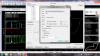
So what exactly happens when you try to join a server? And what if you re-opened the acti app window once in the server and manually pressed launch + connect (from in-game)?Hello all! I just started using this app and have really enjoyed reviewing the telemetry data and trying to improve my times. However, when trying to use during online racing yesterday it would not allow me on track with the other cars/drivers. If I turned off the auto-enable and made sure the app window was not open and re-join the server then I would be able to race with the others. Does anyone have any thoughts on this???

Apps (ACTI) Assetto Corsa Telemetry Interface 1.1.2
- Thread starter KLGreene
- Start date

") .
. 


Latest News
-
 F1 24’s Updated Driver Career Mode DetailedThe new aim of F1 24's driver career is to increase your recognition levels, and ultimately...
- Thomas Harrison-Lord
- Updated:
- 3 min read
-
Assetto Corsa Competizione’s Nordschleife Hits Consoles 2nd MayThe Nürburgring 24hr Pack DLC for Assetto Corsa Competizione arrives this time next week for...
- Thomas Harrison-Lord
- Updated:
- 2 min read
-
 BeamNG Hotfix Adds Vehicle Detail Viewer And A Slew Of FixesBeamNG.drive's 0.32 update has been a huge hit with fans, the obligatory patch to partner the...
- Connor Minniss
- Updated:
- 3 min read
-
Gran Turismo 7’s Update 1.46 Includes Škoda’s Vision GTAn electric concept marks Škoda’s debut within Gran Turismo, and it will be joined by Honda’s...
- Thomas Harrison-Lord
- Updated:
- 4 min read
-
F1 Manager 2024’s New Mentality System, Pitbox Order DetailedAlongside being able to create a custom team, drivers can now be poached, races can be simulated...
- Thomas Harrison-Lord
- Updated:
- 2 min read
-
How The BTCC and Motorsport Games ReunitedIn a surprise move last week, official BTCC content will once again be present within rFactor 2...
- Thomas Harrison-Lord
- Updated:
- 5 min read
-
 Sponsored MOZA Racing & Lamborghini Redefine Racing Boundaries with The Real Race Super Trofeo 2024MOZA Racing proudly announces its collaboration with Lamborghini for the launch of The Real Race...
- OverTake.gg
- Updated:
- 6 min read